Selected Topic
Issue 9 - PREVI revisited – A Contemporary Approach to the Proyecto Experimental de Vivienda in Lima (June 2012)
Show articles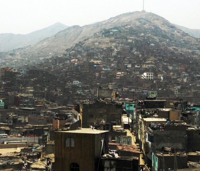
Informal settlement in Cerro San Cosme (Photo: Elsa Monforte and Frankie Caycho.)

Informal settlement in Cerro El Pino (Photo: Elsa Monforte and Frankie Caycho.)
Informal settlement in Cerro El Agustino (Photo: Elsa Monforte and Frankie Caycho.)

Vertical streets in Cerro El Agustino. (Photo: Elsa Monforte and Frankie Caycho.)

Informal “Live music show”, Lima. (Photo: Elsa Monforte and Frankie Caycho.)
Informal settlement in Cruz de Motupe, San Juan de Lurigancho (Photo: Elsa Monforte and Frankie Caycho.)

Informal settlement in Asociación los Huertos de Canto Grande (Photo: Elsa Monforte and Frankie Caycho.)

Vertical street in Asociación los Huertos de Canto Grande” (Photo: Elsa Monforte and Frankie Caycho.)
Informal settlement in Horacio Zevallos, Ate (Photo: Elsa Monforte and Frankie Caycho.)

.Informal settlement in Manchay (Photo: Elsa Monforte and Frankie Caycho.)
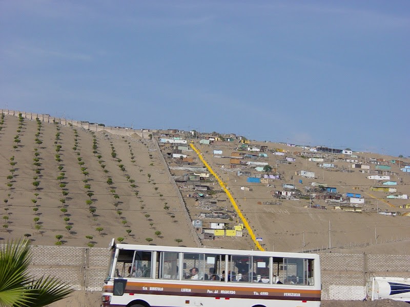
Yellow stairs in informal settlement, Lima.
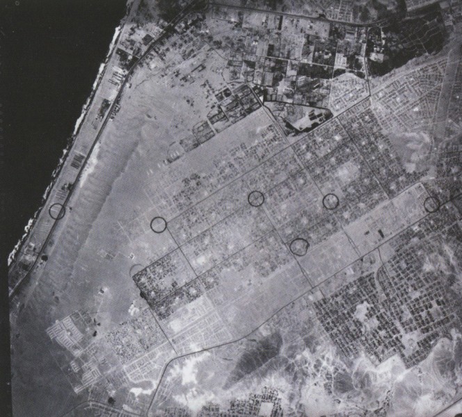
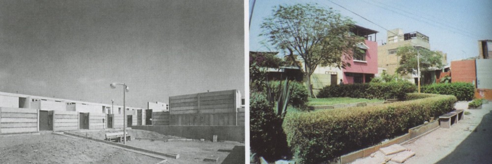
Aerial view of Villa El Salvador, Lima (source:Time builds!, Ed GG/ 2008, Barcelona)
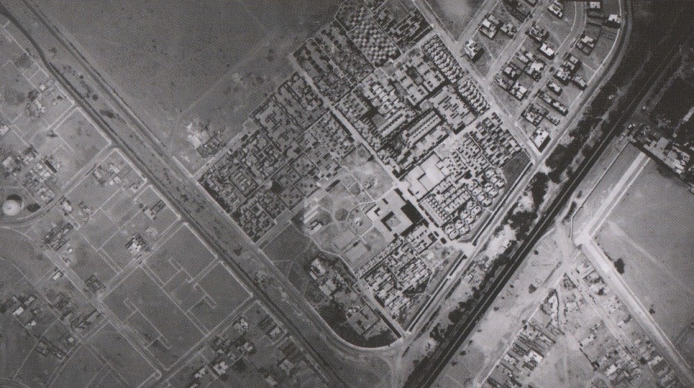
Aerial view of PREVI (source:Architectural design, 211. May/June 2011)
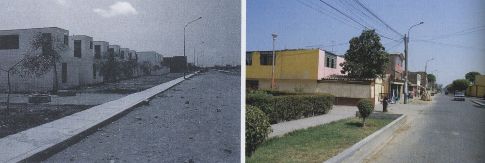
Atelier 5 project in 1978 and 2003 (source:Time builds!, Ed.GG/ 2008, Barcelona)
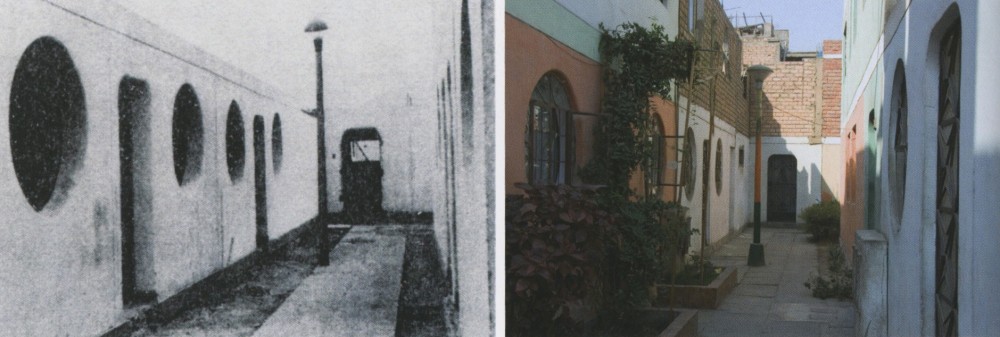
James Stirling project in 1978 and 2003 (source: Time builds!, Ed.GG/ 2008, Barcelona)
Kurokawa-Kikutake-Maki project in 1978 and 2003 (source: Time builds!, Ed.GG/ 2008, Barcelona)
4.7.2012 – Issue 9 - PREVI revisited – Rodriguez Luis – Essays
THE IMPACT OF PREVI ON LIMA
by Luis Rodriguez
THE BARRIADAS OF LIMA AND PREVI
The growth of the neighbourhoods of Lima can be divided into three main periods. The beginning of the first is unclear but it continued up to the occupation of the slopes of the hill ranges of San Cosme (1946) and El Agustino (1947), three kilometres from the Plaza Mayor. This period saw the occupation of small interstitial areas within the city, following an inorganic layout, with no social organization other than the family ties of the invaders and no more resources than poles and pieces of recycled panel. San Cosme highlighted the fact that the Government was facing a completely new problem, as were the city’s people. Middle- and upper-class sectors began their exodus, leaving the city centre and moving southwards, and, for the more disadvantaged sectors, invasion was a “legitimate” way of finding a home.
From 1948 to 1985, the second period, all the sites on occupiable land were urbanized by means of invasions, land-trafficking or legally constructed housing development. During this period, Lima reached its current size and acquired the principal features that characterize it today. Experience showed the invaders that an organized group was less likely to be expelled, and the land-traffickers and the people who planned the invasions accordingly encouraged community organization in the process. The moment came when the Government—particularly the dictatorships—began to require representation in negotiations for political ends. This was a period during which the successive governments utilized the construction of public works as an effective way of driving the economy, and the majority of migrants received a degree of training that allowed them to build their own homes.
Initially, with students and then professionals, the Government provided assistance in planning the settlements, inadvertently training the leaders, who quickly mastered the urban logics that they efficiently replicated, setting aside land for education and health premises, and even for parks and open spaces. Construction skills were also acquired and systematized alongside occupation, with a uniform landscape of matting and eucalyptus branches gradually transforming into brick walls and columns that were never completed, slowly advancing in response to each family’s needs. With individual nuances and moments, this was a period of growth and learning for a city that essentially built itself.
In 1975, when the PREVI was handed over to its owners, with Lima at the final stage of this period, it covered 2,500 km2 of the 3,000 km2 now occupied by the city, and the process of urbanization and construction of homes was following this intense dynamic. By 1985, when the PREVI had existed for 10 years and an assessment could be made, most of the city was occupied and, though presenting a landscape of incomplete homes, the foundations were consolidated and therefore unlikely to be removed. Municipal programmes in the 1980s were minimal, and the small area of city pending growth was to be developed by professionals hired by the invaders, principally taking the form of layouts designed in accordance with the legislation of the time and subsequent regularization. It might be said that the PREVI came late to Lima; even if its contributions had been massively widespread, and the Government or architects had been committed to implementing its advances, the city no longer had available land, and, therefore, the scale of reproduction would have been minimal and inappropriate for the system.
THE PREVI TODAY
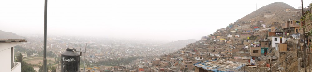
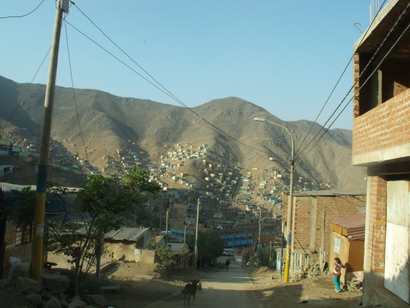
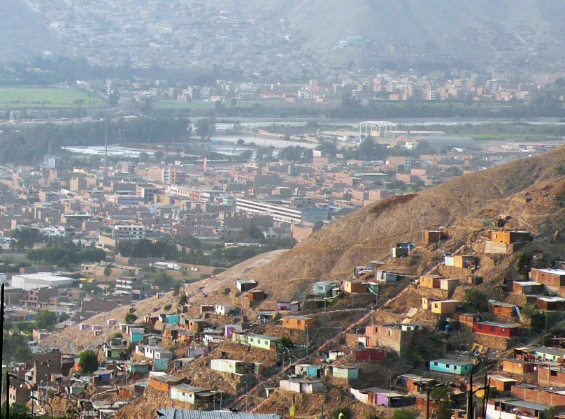
The third and final period of growth began in the late eighties and continues today. With the available flat land and sites with technically recommended gradients taken up, the occupation began of the ravines, the foothills of the Andes that experience huaycos, and areas which, due to their steep gradient (more than 15°), constitute a risk in the event of earthquake. These occupations have taken place gradually and in small groups, never en masse, facing major difficulties of consolidation due to their hazardous location in the event of natural disasters, generating friction with the settled population, which is endangered by the latest invaders. In urban terms and for their location, the layout of these extensions is inadequate, as it disregards the topography and includes no set-aside for open spaces or facilities. Due to the high cost of foundations, they remain precarious for a long time; in fact, 15 years on, some homes remain in the same incipient state. Added to this is the fact that their population is largely unskilled in construction, the majority having been employed in commerce and services in recent decades, which hampers the evolution of the dwellings. Recent studies show that the population that occupies these slopes represents the highest rates of poverty (critical) in the city, but the hazardous location is a hindrance to practical assistance.
Could the PREVI respond to this new reality? The description of the present-day conditions of these populations suggests that it could not. The PREVI was conceived for a type of city—flat, self-constructed and accessible, with the possibility of mass construction—and this kind of city no longer exists on these sites. In the absence of proposals to address these problems and the absence of research into low-cost housing for present-day conditions, in this most recent phase the Government has directed its principal programmes at public space. The last municipal administration conducted the most successful programme, building 3,000 yellow-painted stairways, alongside the consolidation of population in high-risk areas. However, according to recent studies, these are the areas that would suffer greatest damage in the event of an earthquake.
THE PREVI IN THE PROCESS
Although the time of completion of the PREVI prevented impacts on the growth of the city, it did have an influence in the world of architecture, generating some important debates. In 1971, shortly after the competition, the Ministry of Housing designed the Conjunto Habitacional Próceres, an urban proposal that judiciously combined the scale of the single-family dwelling on a minimal plot along pedestrian passages with that of the multi-family buildings with six floors joined by raised streets, around a square at the heart of the neighbourhood. This proposal was followed by “basic nucleus” interventions with services situated indiscriminately in rather generic layouts, the emblematic case being Villa El Salvador.
Huaycán, a project carried out by the leftwing municipality in 1984, was undoubtedly the most important urban experience of the 20th century, with an urban structure based on superblocks to resolve traffic and free up the centre of the block for pedestrians. The arrangement of the blocks is in the spirit of the proposal of some PREVI competition entrants: free open structures that did not impose a determinant geometry. Conversely, the master plan defined the strategy for locating the blocks, that were given their definitive arrangement by participatory processes. The position of the communal centre inside the block defined by the settlers was determinant to the layout of footpaths. The team headed by Eduardo Figari, who was also involved in the Próceres, designed basic housing nucleuses that were developed in conjunction with each family to produce a set of final plans.
Huaycán is a highly successful experience, both in physical spatial terms and socially. The population not only accepted and completed the participatory planning and design process; it subsequently used the proposed structure for its own social organization, quickly becoming a close-knit community. For all of the above, while Huaycán was a vital expression of the impact that the PREVI had on the world of architects, it also distanced itself from this world and the criteria used by Peter Land to develop it, and moved closer to the principles of John Turner, the promoter of the PREVI.
BEYOND AUTONOMY
The origins of the PREVI can be found in the research by John Turner, who aimed to show that “… self-governing network structures and decentralizing technologies are the only ways and means through which satisfactory goods and services can be obtained …” (Turner, p. 31, 1977). Every article, every conclusion of his essays argues that, when managed by the Government, policies and programmes fail. The association practised by Turner, by which participation is to autonomy as government action is to heteronomy, generates a false dichotomy, but it does clarify his opposition to a controlling State. When the discussion turns to the problem of housing—remember, Turner was a lawyer by profession—he calls for the control of land, technology and financing, because “all of us, as citizens, have to slough off the last vestiges of cap-touching filialism and demand that those in power help us do what we can do locally for ourselves” (p. 41).
Turner’s work manifests the aim of disempowering the Government as the bearer of knowledge for development; the Government should provide the resources and leave decisions in the hands of the inhabitants, to be taken by means of a system of networks that allows smooth communication, breaking down hierarchies. In contrast, it is not clear who is to be responsible for intervention—at times, a local government or council, at others, the population, and at others, the population along with architects and urbanists. However, they are all actors with no overall protagonism, who need to know only specific parts of the process, and the impossibility of total knowledge prevents any single party taking overall control. This is the basis of the experimental nature of the PREVI, at least in its gestation and conceptualization: a commitment to produce housing without State control and without the control of the expert knowledge of architects and urbanists.
This kind of urban anarchism contrasts with several subsequent decisions taken in the process of the competition for the construction of the PREVI, the most important of which was to construct a fragment of each winning entry. At first sight, this might be seen as a decision to exchange a single winner for an association of proposals. What it did produce was the appearance of a body that took total control: Peter Land and the ININVI team. Its intervention generated the Master Plan, bringing together and making feasible the 26 constructive and structural systems presented by the participants and finally, organizing the fabrication of the parts defined by each proposal in the floor plan of a single plot. This second moment eliminated any chance of the project’s autonomy, in each aspect and phase substituting Turner’s heteronomy, reinforcing the idea of a State embodied in an organism devoted to research into housing, and architects and urbanists with absolute control of the intervention.
LIMA OVER THE PREVI, OR THE TRIUMPH OF ANARCHY
Although, as explained above, the possibilities of the PREVI’s impact on the development of the city were limited to one-off interventions by certain architects who had always been involved in the question, it is possible, having separated the light cast by Turner’s reflections on the competition and the implementation of the latter, to produce a positive interpretation. Lima, a 70% self-built city is, to a large extent, proof that Turner’s theses were not unsound. It is clear that the demand for autonomy has no meaning in environments such as Latin American cities, where it is precisely indifference that leaves the population to look after itself while attending to middle- or upper-class sectors. However, between 1985 and 1995, when Peru was ravaged by terrorism, economic crisis and recession, this self-generated, informal city provided support for the economy. Both at macro level, constructing commercial and productive centres, and at a more domestic level, building networks of solidarity with soup kitchens and other forms of collaboration that allowed the subsistence of much of the population.
Though the experiences of the PREVI cannot be applied at present due to the predominance of other urban problems, the model of development, anarchic in the best sense of the word, that underpins the PREVI, still has the potential to be exploited and taken to higher levels. If, in Lima, autonomy generated dwellings, public spaces, basic services, facilities, its own industry and, finally, an urban culture that is the product of combining the contributions of a variety of fields, why should it stop there?
1. The competition was organized in 1968.
2. Matos Mar names Armatambo in 1924 as the first barriada.
3. This does not include Ciudad Pachacútec.
4. SINAMOS was the Sistema Nacional de Movilización Social [National System of Social Mobilization], a support agency involving social scientists, engineers, architects, etc.
5. In the case of Comas, for example, in 1958.
6. The mass occupations of Ciudad de Dios in 1958, Villa E Salvador in 1971 and Huaycán in 1984.
7. A Quechua word for the mud- and rockslides produced by the rains
8. Its settlers mostly belonged to unions associated with Peru’s left wing of the time.
9. Gamarra is a textile concern made up entirely of migrants, where the land prices per square metre are the most expensive in Lima.
Download article as PDF